
Neighborhood guides
South Brooklyn, neighborhood by neighborhood
5 neighborhoods compared on real sale prices, transit, parks and flood risk, from public data, with local insight from Stipple agents.
- 1-family median sale
- $1.25M
- 222 sales
- 2-family median sale
- $1.45M
- 409 sales
- Condo median sale
- $752K
- 285 sales
- Average commute
- 44 min
- 45% commute by transit
NYC Department of Finance sales, October 2025 – September 2026; U.S. Census Bureau ACS 2020–2024.
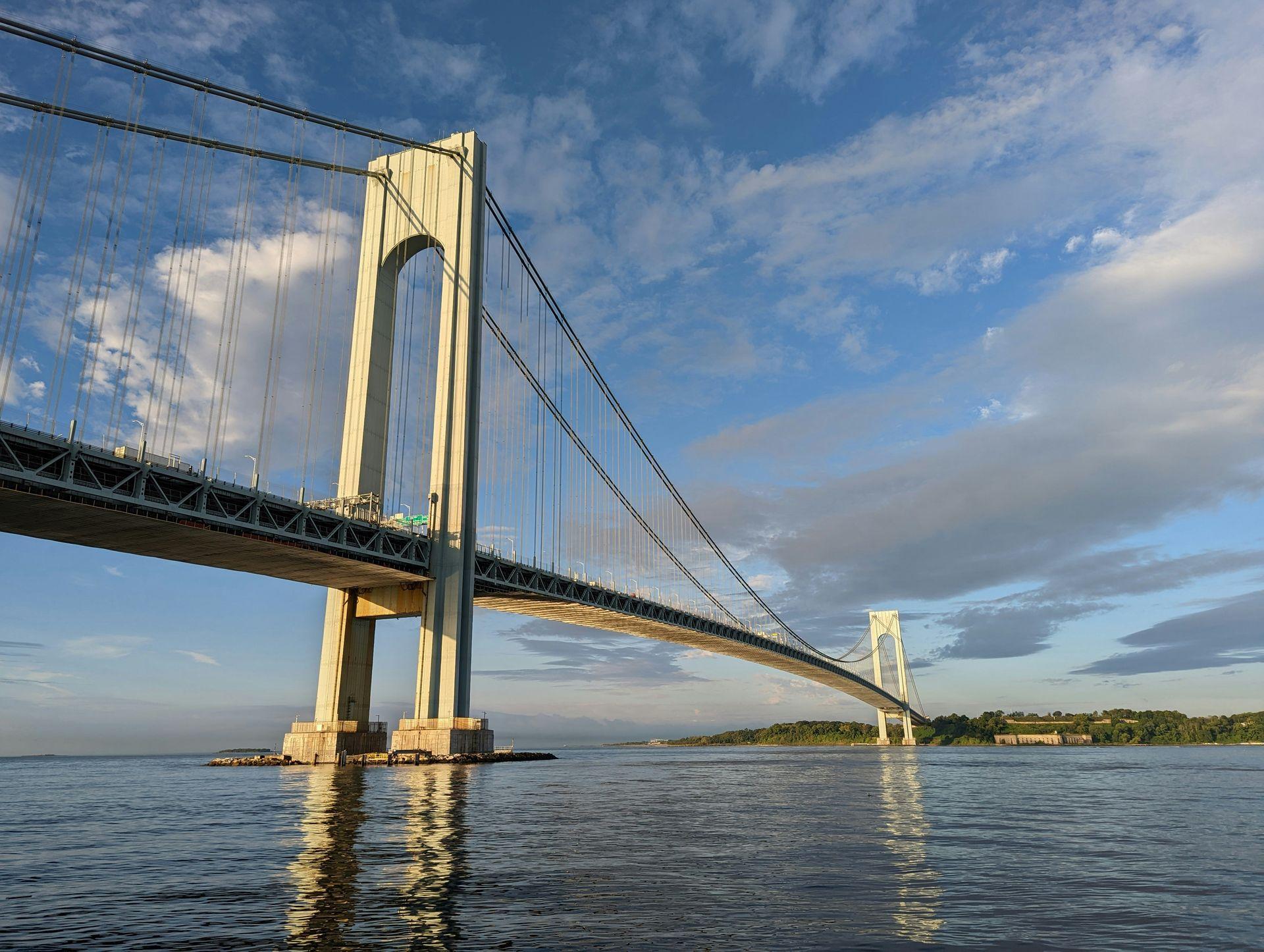
Brooklyn is the most populous of the five boroughs and one of the most varied, stretching from the East River waterfront to Coney Island and Jamaica Bay. Our guides currently cover South Brooklyn's western edge: Sunset Park, Bay Ridge, Dyker Heights, Bensonhurst and Bath Beach, a band of neighborhoods along the Upper Bay, the Narrows and Gravesend Bay.
This part of Brooklyn is dense but low-rise: brick and limestone row houses, two-family houses and small apartment buildings, with larger apartment buildings along the avenues and the shore. Subway lines run the length of it toward Manhattan, NYC Ferry stops at two landings, and the Verrazzano-Narrows Bridge connects it directly to Staten Island.
Map
Explore South Brooklyn
Shade the areas by price, commute, transit use, flood exposure or parkland. Select a dot to open that neighborhood's guide.
- 1-family median price, by area
- $990K
- $995K
- $1.22M
- $1.35M
- Not enough sales / no data
- Neighborhood guide
View area data as a table
| Area (NYC NTA) | 1-family median price | Average commute | Commute by transit | Lots in FEMA 1% floodplain | Park acres |
|---|---|---|---|---|---|
| Bay Ridge | $1.35M | 44 min | 43% | 0.1% | 121 |
| Dyker Heights | $1.22M | 44 min | 39% | 0.0% | 11 |
| Bensonhurst | $995K | 44 min | 48% | 0.0% | 7 |
| Bath Beach | $990K | 45 min | 43% | 0.1% | 21 |
| Sunset Park (West) | — | 39 min | 49% | 1.6% | 9 |
| Sunset Park (Central) | — | 46 min | 47% | 0.0% | 25 |
Neighborhood matcher
Find your South Brooklyn match
Set your budget, home type and how you'll get to Manhattan. We rank all 5 neighborhoods using public data.
Your best matches
#1 · South Brooklyn
Bath Beach
- 18 Av station 0.4 mi
#2 · South Brooklyn
Bensonhurst
- 79 St station 0.3 mi
#3 · South Brooklyn
Bay Ridge
- 86 St station 0.3 mi
See all 5 neighborhoods ranked
- 01Bath Beach$997K
- 02Bensonhurst$1.08M
- 03Bay Ridge$1.35M
- 04Sunset Park$1.4M
- 05Dyker Heights$1.2M
Neighborhoods
South Brooklyn
From Sunset Park's hilltop park and industrial waterfront south through Bay Ridge's Shore Road and the hilltop streets of Dyker Heights to Bensonhurst and Bath Beach on Gravesend Bay. The R runs under Fourth Avenue, the D and N run toward Coney Island, and a waterfront promenade follows much of the shore from the 69th Street Pier past the Verrazzano-Narrows Bridge.
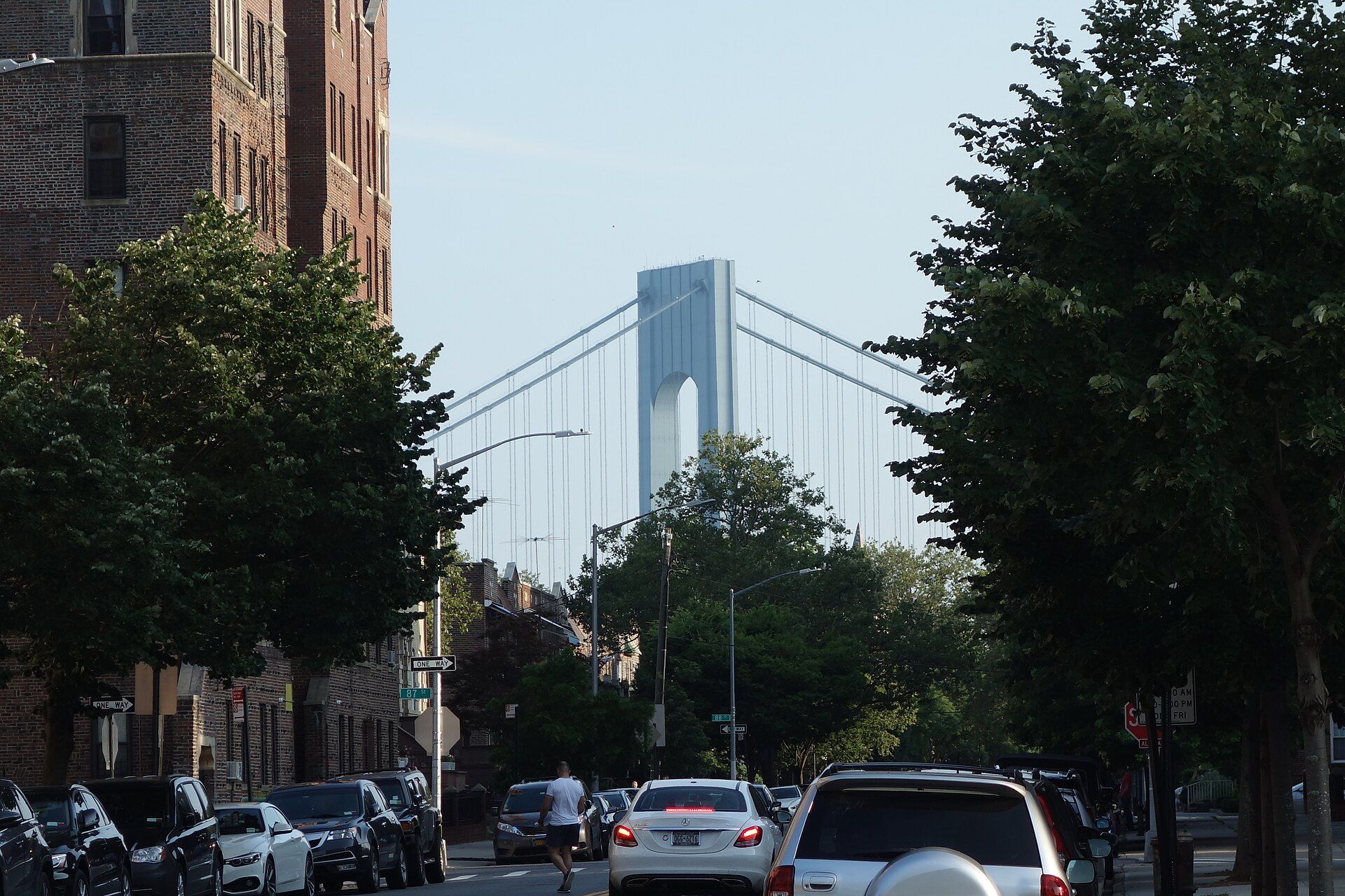
Bay Ridge
Row houses and apartment buildings on a ridge above the Narrows, with Shore Road, a waterfront promenade to the Verrazzano and the R train to 95th Street.
1-family $1.35M · 86 St 0.3 mi
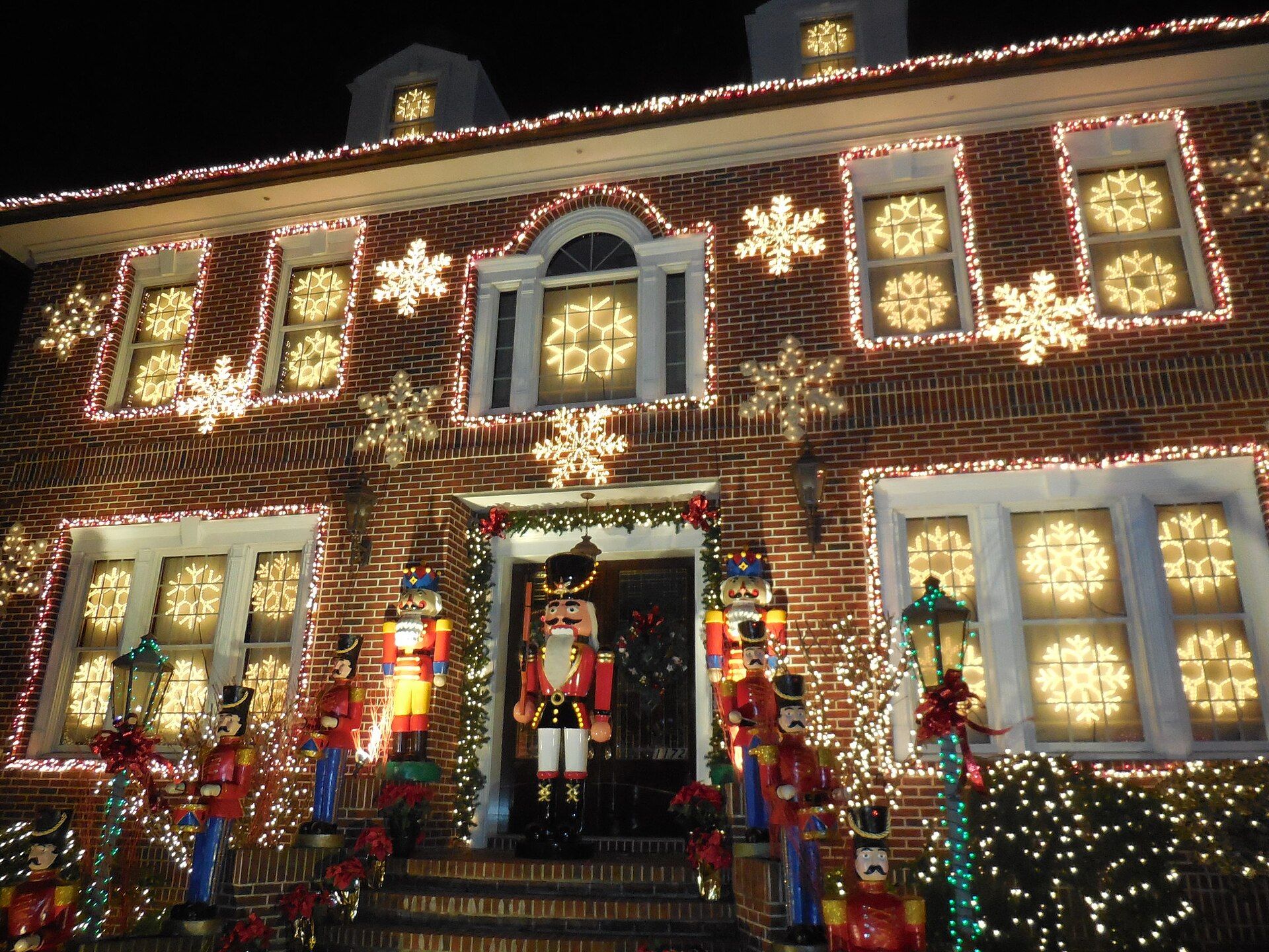
Dyker Heights
A hilltop of detached houses with driveways between Bay Ridge and Bensonhurst, beside Dyker Beach Park and its public golf course.
1-family $1.2M · 71 St 0.6 mi
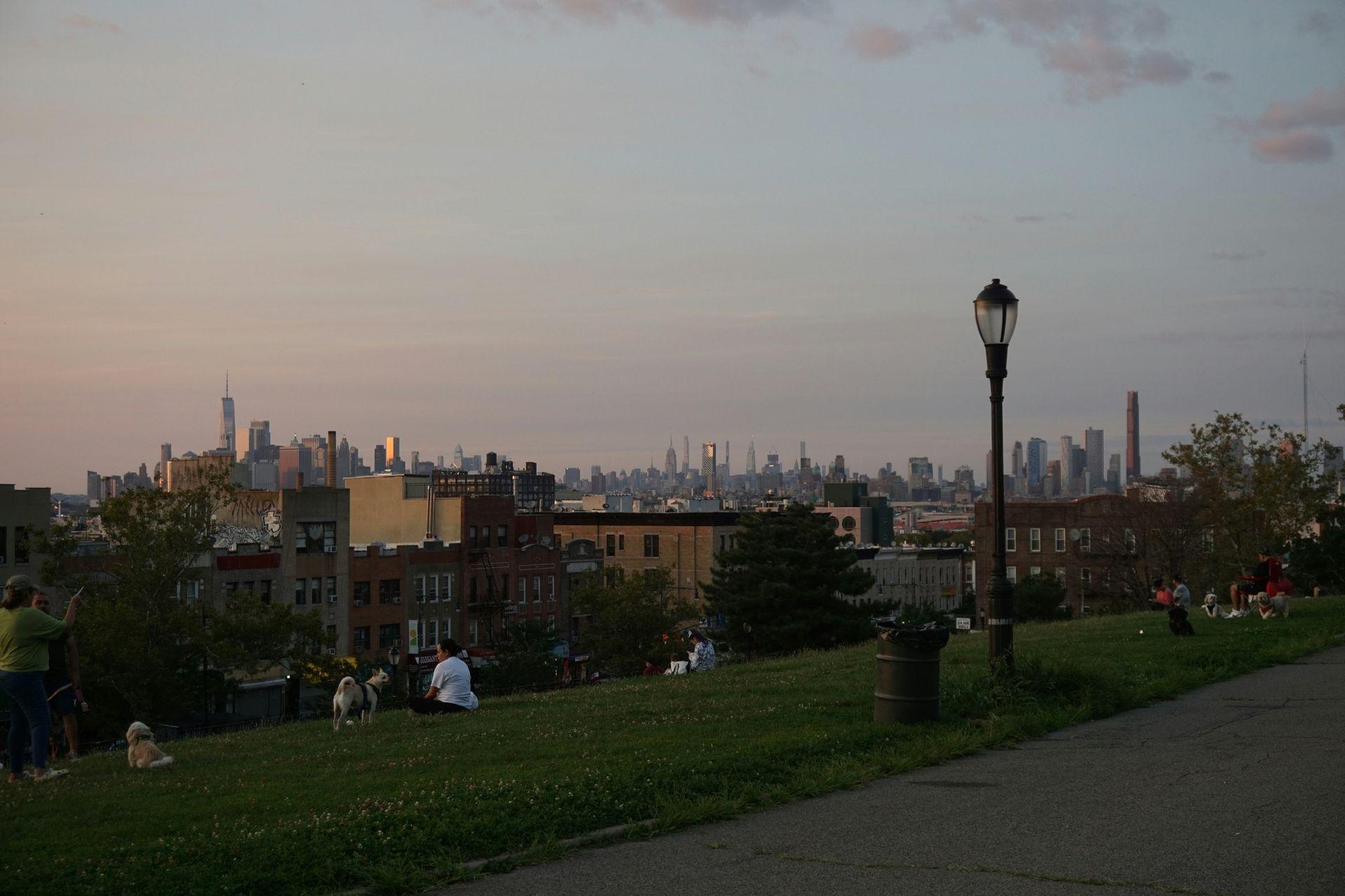
Sunset Park
Brick row houses climbing to a hilltop park with harbor views, above a working waterfront of Industry City, Bush Terminal and the Brooklyn Army Terminal.
1-family $1.4M · 45 St 0.3 mi
Bensonhurst
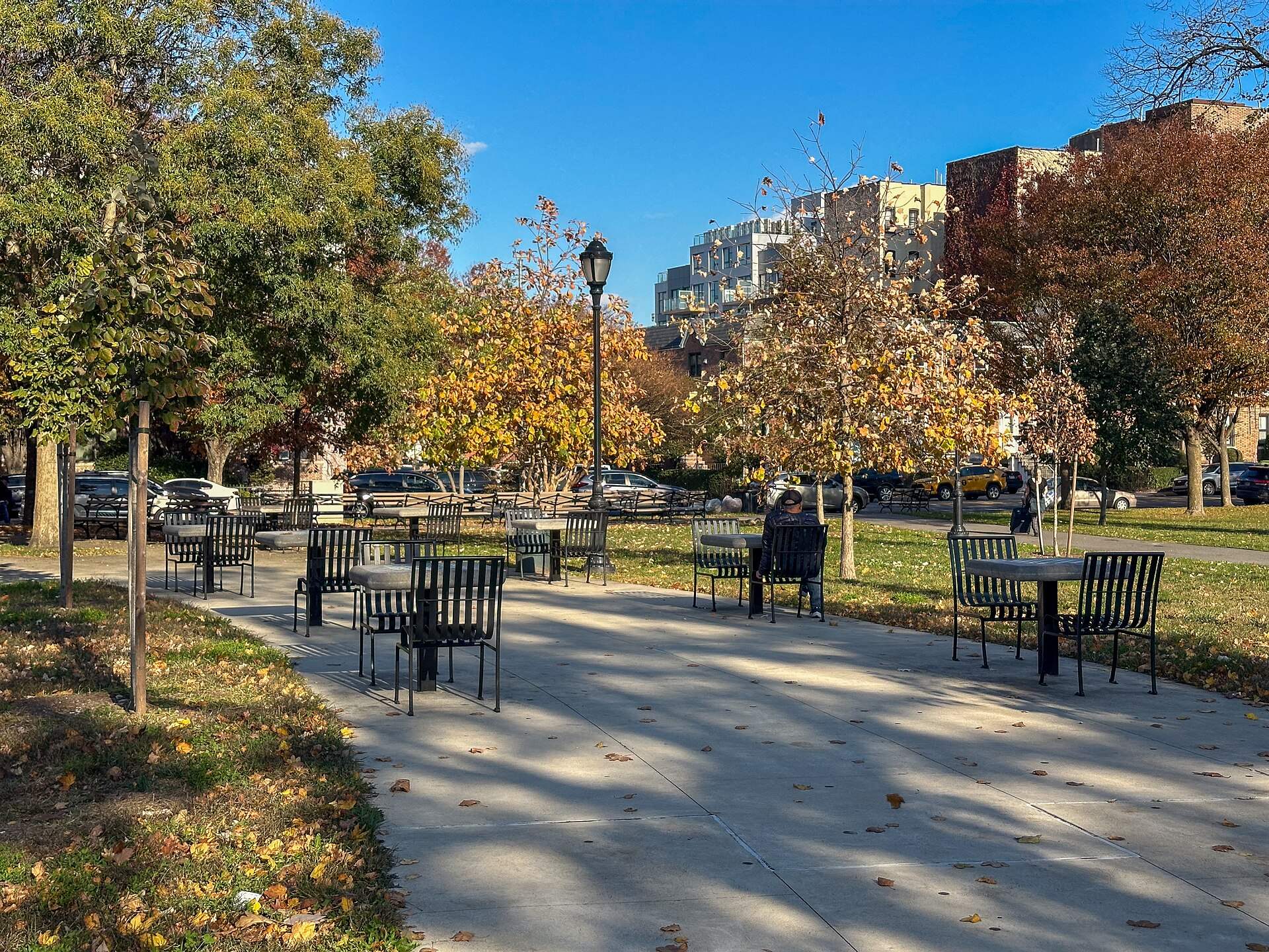
Attached houses and small apartment buildings between 18th Avenue's shops and 86th Street's stores under the elevated West End Line.
1-family $1.08M · 79 St 0.3 mi
- Bath Beach
Bath Beach
Semi-attached houses and small apartment buildings on Gravesend Bay, with the Shore Parkway promenade, Bensonhurst Park and the elevated D on 86th Street.
1-family $997K · 18 Av 0.4 mi
Getting around
Transit & flood primers
Subway
The R runs local under Fourth Avenue through Sunset Park and Bay Ridge to Bay Ridge-95th Street. The D runs express on Fourth Avenue to 36th Street and the N to 59th Street; further south the D runs on the elevated West End Line over New Utrecht Avenue and 86th Street through Bensonhurst and Bath Beach, and the N runs on the Sea Beach Line, mostly in an open cut, toward Coney Island. Service patterns change on nights and weekends, so check the MTA for current routes.
NYC Ferry
Since December 2025, NYC Ferry's St. George route has stopped at the Bay Ridge landing on the 69th Street Pier, with service to Atlantic Avenue/Pier 6, Wall Street/Pier 11, St. George on Staten Island, Battery Park City and Midtown West. The Rockaway-Soundview route stops at the Sunset Park/BAT landing at the Brooklyn Army Terminal. Check ferry.nyc for schedules.
Express bus
MTA express buses run from Bay Ridge and from Bensonhurst and Bath Beach to Manhattan, charging a premium fare with most trips at rush hours. Across the Verrazzano-Narrows Bridge, the S79 Select Bus Service links Bay Ridge's R train to Staten Island's Hylan Boulevard.
Flood risk & disclosure
Brooklyn has a long, low shoreline, and Hurricane Sandy in 2012 flooded parts of it, including waterfront areas such as Red Hook and Coney Island. In South Brooklyn, most of Bay Ridge and residential Sunset Park sit on high ground, while Sunset Park's industrial waterfront, the strip along the Belt Parkway and the blocks closest to Gravesend Bay are lower. Before you buy or rent, look up the specific address on FEMA's Flood Map Service Center and the NYC Flood Hazard Mapper, which shows FEMA's effective maps alongside the preliminary maps the city uses for some building rules. If a building with a federally backed mortgage sits in a FEMA high-risk zone (a Special Flood Hazard Area), the lender will require flood insurance; outside those zones it is optional but worth pricing. New York also requires disclosure. Since March 20, 2024, sellers of most residential property must complete the state's Property Condition Disclosure Statement, which includes questions about whether the property is in a FEMA floodplain, has flood insurance or has had flood damage claims or FEMA assistance (the old $500 credit in lieu of the form was eliminated). Since June 21, 2023, landlords must include a flood history and risk notice in residential leases under Real Property Law §231-b, stating whether the property is in a FEMA floodplain and whether it has had flood damage, and noting that renters' insurance generally does not cover flood losses.
Compare
Two neighborhoods, side by side
| Metric | Bay Ridge | Bath Beach |
|---|---|---|
| 1-family median sale | $1.35M | $997K |
| 2-family median sale | $1.45M | $1.28M |
| Condo median sale | $863K | $578K |
| Typical lot (sold homes) | 2,100 sq ft | 2,120 sq ft |
| Nearest station | 86 St (R) · 0.3 mi | 18 Av (D) · 0.4 mi |
| Nearest ferry | Bay Ridge · 1.0 mi | — |
| Express bus routes nearby | X27, X28, X37, X38 | X28, X38 |
| Average commute (area) | 44 min | 45 min |
| Commute by transit (area) | 43% | 43% |
| Owner-occupied homes (area) | 37% | 41% |
| Parks within ¾ mile | 6 (291 acres) | 6 (999 acres) |
| Lots in FEMA 1% floodplain (area) | 0.1% | 0.1% |
FAQ
Moving to South Brooklyn
Which subway lines serve South Brooklyn?
The R runs under Fourth Avenue through Sunset Park and Bay Ridge, the D runs on the elevated West End Line through Bensonhurst and Bath Beach, and the N runs on the Sea Beach Line through Sunset Park's east side and Bensonhurst. The D and N run express along Fourth Avenue north of 36th Street.
Is there a ferry from South Brooklyn to Manhattan?
Yes. NYC Ferry's St. George route stops at Bay Ridge's 69th Street Pier and continues to Wall Street/Pier 11, and the Rockaway-Soundview route stops at the Brooklyn Army Terminal in Sunset Park.
How do you get from South Brooklyn to Staten Island?
Drive across the Verrazzano-Narrows Bridge, take the S79 Select Bus Service from Bay Ridge, or take NYC Ferry's St. George route from the 69th Street Pier to St. George.
Where can I check whether a Brooklyn home is in a flood zone?
Use FEMA's Flood Map Service Center and the NYC Flood Hazard Mapper for the exact address. Sellers must also answer flood questions on New York's Property Condition Disclosure Statement, and landlords must include a flood history and risk notice in residential leases.
About this data: area figures use NYC Department of City Planning 2020 Neighborhood Tabulation Areas; neighborhood sales use Department of Finance neighborhood names. Sources: 2020 Neighborhood Tabulation Areas (NTAs) (Updated 2026-11-02); 2020 Census Tracts to 2020 NTAs Equivalency (Updated 2021-09-20); Citywide Rolling Calendar Sales (totals cover South Brooklyn: Bay Ridge, Dyker Heights, Sunset Park, Bensonhurst, Bath Beach) (Updated 2026-10-15); Citywide Annualized Calendar Sales (trend and neighborhood points) (Updated 2026-06-09); Primary Land Use Tax Lot Output (PLUTO) (Updated 2026-08-24); Parks Properties (Updated 2026-10-16); Beaches (Updated 2026-10-15); Facilities Database (Updated 2026-07-16); American Community Survey 5-year estimates (tables B25003, B25024, B25034, B08013, B08303, B08301, B25044) (2020–2024 ACS 5-year); MTA GTFS static feed: subway and Staten Island Railway (Schedule from 2026-11-01); MTA GTFS static feed: Brooklyn buses (Schedule from 2026-10-08); MTA GTFS static feed: MTA Bus Company (Schedule from 2026-10-09); NYC Ferry GTFS static feed (Schedule from 2026-11-02). Stipple is committed to fair housing: these guides describe places, homes, prices and access, never the people who live there, and every neighborhood gets the same data.
Neighborhoods
Talk to a local agent
Tell us what you're looking for. A licensed Stipple agent will share homes that fit, and we'll let you know when new listings go live in the neighborhoods you pick.
Prefer to call? 718.333.5499